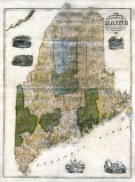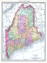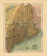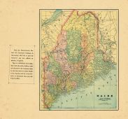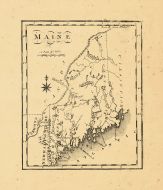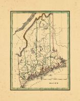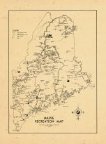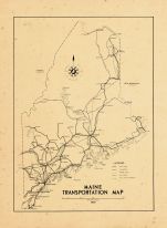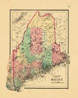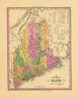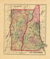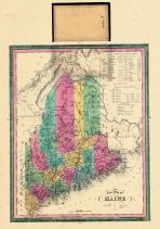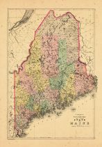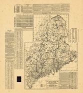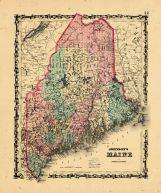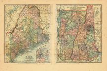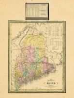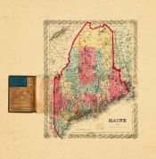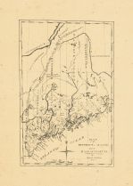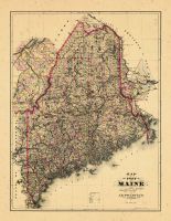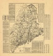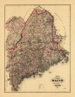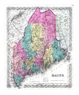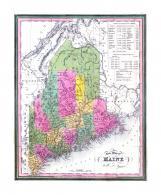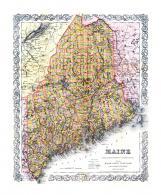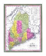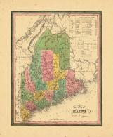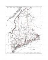
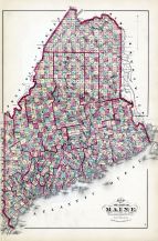
| Maine State Map |
Maine |
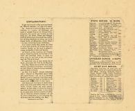
Maine State Atlas 1961 to 1964 High... |
Maine State Hig... |
1961 |
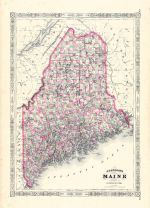
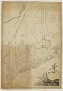
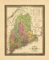
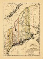
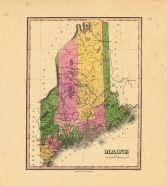
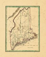
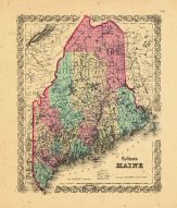
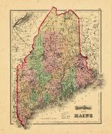
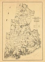
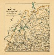
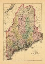
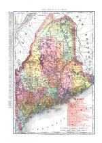
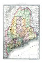
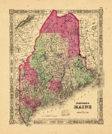
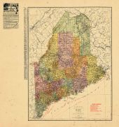
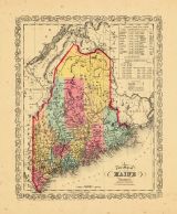
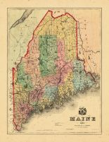
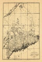
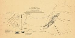
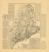
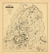
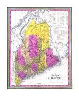
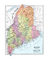
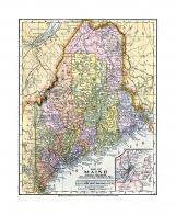
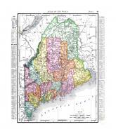
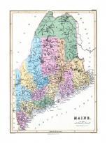
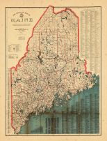
| Maine Geological Map |
Maine |
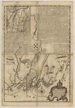
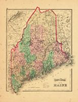
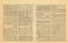
Maine State Atlas 1884 |
Geo N. Colby & ... |
1884 |

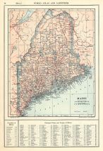
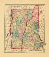
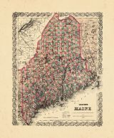
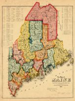
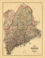
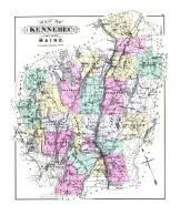
| Maine |
Minnesota |
Otter Tail County 1974 |
Title Atlas Com... |
1974 |

| Maine |
Minnesota |
Otter Tail County 1982 |
Title Atlas Com... |
1982 |

| Maine |
Minnesota |
Otter Tail County 1993 |
Title Atlas Com... |
1993 |

| Maine |
Minnesota |
Otter Tail County 1993 |
Farm and Home P... |
1993 |

| New Maine |
Minnesota |
Marshall County 1973 |
Title Atlas Com... |
1973 |

| New Maine |
Minnesota |
Marshall County 1982 |
Title Atlas Com... |
1982 |

| Maine |
Minnesota |
Otter Tail County 1933 |
Thomas O. Nelso... |
1933 |

| Maine |
Minnesota |
Otter Tail County 1953 |
Thomas O. Nelso... |
1953 |

| Maine 2 |
New York |
Broome County 1908 |
Northwest Publi... |
1908 |

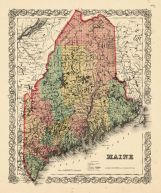
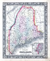
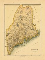
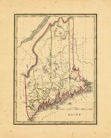
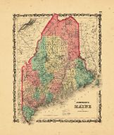
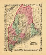
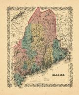
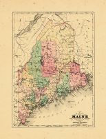
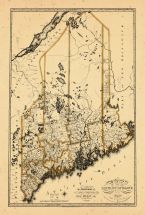
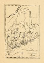
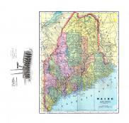
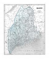
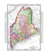
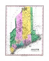
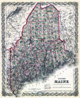
| Maine State County Map 1860 |
Maine |
Maine State Map 1860 |
Augustus Mitche... |
1860 |
| Maine |
Indiana |
Wells County 1881 |
H.H. Hardesty |
1881 |

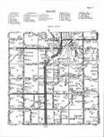
| Maine Township |
Wisconsin |
Outagamie County 1954 |
Farm Plat Book ... |
1954 |

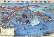
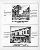
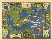
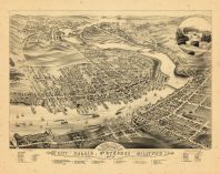
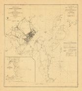
| Page 018 - Principal Maine Yacht Clubs |
Maine |
Portland 1955 Hay's Guide to Portla... |
Hay's Drug Stor... |
1955 |

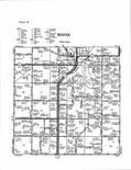
| Maine Township |
Minnesota |
Otter Tail County 1960 |
Thomas O. Nelso... |
1960 |
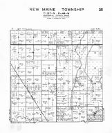
| New Maine Township |
Minnesota |
Marshall County 1941 |
Lyle Wood-Baude... |
1941 |

| Maine Page 074 |
Wisconsin |
Marathon County 1930 |
Webb Publishing |
1930 |

| Maine Page 076 |
Wisconsin |
Marathon County 1930 |
Webb Publishing |
1930 |

| Maine T85N-R6W |
Iowa |
Linn County 1957 |
Directory Servi... |
1957 |

| Maine T85N-R6W |
Iowa |
Linn County 1978 |
Directory Servi... |
1978 |

| Maine T85N-R6W |
Iowa |
Linn County 1979 |
Directory Servi... |
1979 |

| Maine T85N-R6W |
Iowa |
Linn County 1981 |
Directory Servi... |
1981 |

| Maine T85N-R6W |
Iowa |
Linn County 1985 |
Directory Servi... |
1985 |

| Maine T85N-R6W |
Iowa |
Linn County 1996 - 1997 |
R. C. Booth Ent... |
1996 |

| Maine T85N-R6W |
Iowa |
Linn County 1996 - 1997 |
R. C. Booth Ent... |
1996 |
| Maine T85N-R6W |
Iowa |
Linn County 2007 - 2008 |
R. C. Booth Ent... |
2007 |

| Maine T85N-R6W |
Iowa |
Linn County 2007 - 2008 |
R. C. Booth Ent... |
2007 |
| Maine T85N-R6W |
Iowa |
Linn County 1994 - 1995 |
R. C. Booth Ent... |
1994 |

| Maine T85N-R6W |
Iowa |
Linn County 1994 - 1995 |
R. C. Booth Ent... |
1994 |

| Maine T85N-R6W |
Iowa |
Linn County 2003 - 2004 |
R. C. Booth Ent... |
2003 |

| Maine T85N-R6W |
Iowa |
Linn County 2003 - 2004 |
R. C. Booth Ent... |
2003 |
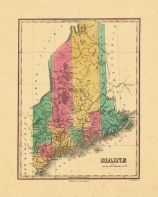
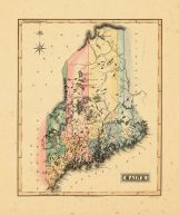
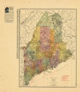
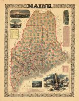
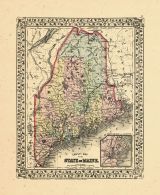
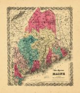
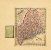
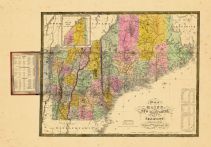
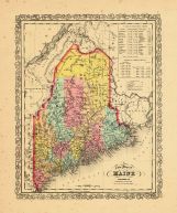
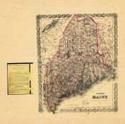
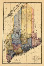
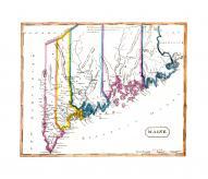
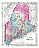
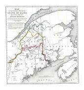
| Coltons Maine |
Maine |
Oxford County 1880 |
Caldwell & Half... |
1880 |

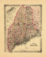
| Maine State Map |
Maine |
Penobscot County 1875 |
Comstock & Clin... |
1875 |
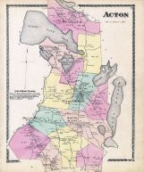
| Acton, Maine |
Maine |
York County 1872 |
Sanford, Everts... |
1872 |

| Maine Township |
Wisconsin |
Outagamie County 1955c |
Forde Printing ... |
1955c |

| New Maine Township |
Minnesota |
Marshall County 1928 |
Brock and Compa... |
1928 |
| Maine, Buffalo |
Iowa |
Linn County 1907 |
Iowa Publishing... |
1907 |

| Maine - North |
Wisconsin |
Marathon County 1930 |
Webb Publishing |
1930 |

| Maine - South |
Wisconsin |
Marathon County 1930 |
Webb Publishing |
1930 |

| Maine and Maineville |
Pennsylvania |
Columbia and Montour Counties 1876 |
F. W. Beers & C... |
1876 |

| Maine Township |
Iowa |
Linn County 1956 |
R. C. Booth Ent... |
1956 |

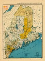
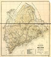
| Maine Railroad Map 1906 |
Maine |
Maine Railroad Map 1906 |
Rand-McNally |
1906 |
| Maine Railroad Map 1899 |
Maine |
Maine Railroad Map 1899 |
Allen, William ... |
1899 |
| State of Maine |
Maine |
Cumberland County 1871 |
F. W. Beers & C... |
1871 |

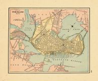
| 22, 4th, Maine, Lincoln New |
Maine |
Portland 1886 |
Sanborn Map and... |
1886 |
| Maine Township, Phelps |
Minnesota |
Otter Tail County 1925 |
The Farmer - We... |
1925 |

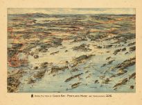
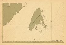
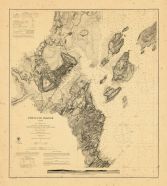
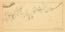
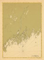
| Casco Bay Chart 1933 Number 315 Maine |
Maine |
Casco Bay Chart 1933 Number 315 Mai... |
U. S. Coast and... |
1933 |

| Maine Prairie Township |
Minnesota |
Stearns County 1912 |
P.V. Collins Pu... |
1912 |

| Maine, Braceville T32N-R8E |
Illinois |
Grundy County 1966 |
Directory Servi... |
1966 |
|
| Maine T134N-R41W |
Minnesota |
Ottertail County 1981 |
Directory Servi... |
1981 |
|
| Maine T134N-R41W |
Minnesota |
Ottertail County 1980 |
Directory Servi... |
1980 |
|
| Maine T134N-R41W |
Minnesota |
Ottertail County 1979 |
Directory Servi... |
1979 |
|
| Maine T134N-R41W |
Minnesota |
Ottertail County 1972 |
Directory Servi... |
1972 |
|
| New Maine T157N-R44W |
Minnesota |
Marshall County 1978 |
Directory Servi... |
1978 |
|
| New Maine T157N-R44W |
Minnesota |
Marshall County 1976 |
Directory Servi... |
1976 |
|
| New Maine T157N-R44W |
Minnesota |
Marshall County 1988 |
Farm and Home P... |
1988 |
|
| New Maine T157N-R44W |
Minnesota |
Marshall County 1990 |
Farm and Home P... |
1990 |
|
| New Maine T157N-R44W |
Minnesota |
Marshall County 1990 |
Farm and Home P... |
1990 |
|
| New Maine T157N-R44W |
Minnesota |
Marshall County 1991 |
Farm and Home P... |
1991 |
|
| New Maine T157N-R44W |
Minnesota |
Marshall County 1991 |
Farm and Home P... |
1991 |
|
| New Maine T157N-R44W |
Minnesota |
Marshall County 1992 |
Farm and Home P... |
1992 |
|
| New Maine T157N-R44W |
Minnesota |
Marshall County 1992 |
Farm and Home P... |
1992 |
|
| New Maine T157N-R44W |
Minnesota |
Marshall County 1993 |
Farm and Home P... |
1993 |
|
| New Maine T157N-R44W |
Minnesota |
Marshall County 1993 |
Farm and Home P... |
1993 |
|
| New Maine T157N-R44W |
Minnesota |
Marshall County 1994 |
Farm and Home P... |
1994 |
|
| New Maine T157N-R44W |
Minnesota |
Marshall County 1994 |
Farm and Home P... |
1994 |
|
| Maine, Braceville T32N-R8E |
Illinois |
Grundy County 1995 |
Farm and Home P... |
1995 |
|
| Maine, Braceville T32N-R8E |
Illinois |
Grundy County 1995 |
Farm and Home P... |
1995 |
|
| Maine, Braceville T32N-R8E |
Illinois |
Grundy County 1995 |
Farm and Home P... |
1995 |
|
| Maine, Braceville T32N-R8E |
Illinois |
Grundy County 1995 |
Farm and Home P... |
1995 |
|
| New Maine T157N-R44W |
Minnesota |
Marshall County 1995 |
Farm and Home P... |
1995 |
|
| New Maine T157N-R44W |
Minnesota |
Marshall County 1995 |
Farm and Home P... |
1995 |
|
| Maine, Braceville T32N-R8E |
Illinois |
Grundy County 1996 |
Farm and Home P... |
1996 |
|
| Maine, Braceville T32N-R8E |
Illinois |
Grundy County 1996 |
Farm and Home P... |
1996 |
|
| Maine, Braceville T32N-R8E |
Illinois |
Grundy County 1996 |
Farm and Home P... |
1996 |
|
| Maine, Braceville T32N-R8E |
Illinois |
Grundy County 1996 |
Farm and Home P... |
1996 |
|
| New Maine T157N-R44W |
Minnesota |
Marshall County 1996 |
Farm and Home P... |
1996 |
|
| New Maine T157N-R44W |
Minnesota |
Marshall County 1996 |
Farm and Home P... |
1996 |
|
| Maine, Braceville T32N-R8E |
Illinois |
Grundy County 1997 |
Farm and Home P... |
1997 |
|
| Maine, Braceville T32N-R8E |
Illinois |
Grundy County 1997 |
Farm and Home P... |
1997 |
|
| Maine, Braceville T32N-R8E |
Illinois |
Grundy County 1997 |
Farm and Home P... |
1997 |
|
| Maine, Braceville T32N-R8E |
Illinois |
Grundy County 1997 |
Farm and Home P... |
1997 |
|
| New Maine T157N-R44W |
Minnesota |
Marshall County 1998 |
Farm and Home P... |
1998 |
|
| New Maine T157N-R44W |
Minnesota |
Marshall County 1998 |
Farm and Home P... |
1998 |
|
| Maine, Braceville T32N-R8E |
Illinois |
Grundy County 1999 |
Farm and Home P... |
1999 |
|
| Maine, Braceville T32N-R8E |
Illinois |
Grundy County 1999 |
Farm and Home P... |
1999 |
|
| Maine, Braceville T32N-R8E |
Illinois |
Grundy County 1999 |
Farm and Home P... |
1999 |
|
| Maine, Braceville T32N-R8E |
Illinois |
Grundy County 1999 |
Farm and Home P... |
1999 |
|
| Maine, Braceville T32N-R8E |
Illinois |
Grundy County 2000 |
Farm and Home P... |
2000 |
|
| Maine, Braceville T32N-R8E |
Illinois |
Grundy County 2000 |
Farm and Home P... |
2000 |
|
| Maine, Braceville T32N-R8E |
Illinois |
Grundy County 2000 |
Farm and Home P... |
2000 |
|
| Maine, Braceville T32N-R8E |
Illinois |
Grundy County 2000 |
Farm and Home P... |
2000 |
|
| Maine, Braceville T32N-R8E |
Illinois |
Grundy County 2001 |
Farm and Home P... |
2001 |
|
| Maine, Braceville T32N-R8E |
Illinois |
Grundy County 2001 |
Farm and Home P... |
2001 |
|
| Maine, Braceville T32N-R8E |
Illinois |
Grundy County 2001 |
Farm and Home P... |
2001 |
|
| Maine, Braceville T32N-R8E |
Illinois |
Grundy County 2001 |
Farm and Home P... |
2001 |
|
| Maine, Braceville T32N-R8E |
Illinois |
Grundy County 2003 |
Farm and Home P... |
2003 |
|
| Maine, Braceville T32N-R8E |
Illinois |
Grundy County 2003 |
Farm and Home P... |
2003 |
|
| Maine, Braceville T32N-R8E |
Illinois |
Grundy County 2003 |
Farm and Home P... |
2003 |
|
| Maine, Braceville T32N-R8E |
Illinois |
Grundy County 2003 |
Farm and Home P... |
2003 |
|
| Maine, Braceville T32N-R8E |
Illinois |
Grundy County 2004 |
Farm and Home P... |
2004 |
|
| Maine, Braceville T32N-R8E |
Illinois |
Grundy County 2004 |
Farm and Home P... |
2004 |
|
| Maine, Braceville T32N-R8E |
Illinois |
Grundy County 2004 |
Farm and Home P... |
2004 |
|
| Maine, Braceville T32N-R8E |
Illinois |
Grundy County 2004 |
Farm and Home P... |
2004 |
|
| Maine, Braceville T32N-R8E |
Illinois |
Grundy County 2005 |
Farm and Home P... |
2005 |
|
| Maine, Braceville T32N-R8E |
Illinois |
Grundy County 2005 |
Farm and Home P... |
2005 |
|
| Maine, Braceville T32N-R8E |
Illinois |
Grundy County 2005 |
Farm and Home P... |
2005 |
|
| Maine, Braceville T32N-R8E |
Illinois |
Grundy County 2005 |
Farm and Home P... |
2005 |
|
| Maine T24N-R16E |
Wisconsin |
Outagamie County 2004 |
Farm and Home P... |
2004 |
|
| Page 008 A - Maine Township |
Illinois |
Chicago 1946 Land Value Blue Book |
Olcott |
1946 |
|
| Page 008 B - Maine Township |
Illinois |
Chicago 1946 Land Value Blue Book |
Olcott |
1946 |
|
| Page 008 C - Maine Township |
Illinois |
Chicago 1946 Land Value Blue Book |
Olcott |
1946 |
|
| Page 012 B - Maine Township |
Illinois |
Chicago 1946 Land Value Blue Book |
Olcott |
1946 |
|
| Page 012 C - Maine Township |
Illinois |
Chicago 1946 Land Value Blue Book |
Olcott |
1946 |
|
| Page 012 D - Maine Township |
Illinois |
Chicago 1946 Land Value Blue Book |
Olcott |
1946 |
|
| Page 012 E - Maine Township |
Illinois |
Chicago 1946 Land Value Blue Book |
Olcott |
1946 |
|
| Page 012 F - Maine Township |
Illinois |
Chicago 1946 Land Value Blue Book |
Olcott |
1946 |
|
| Page 017 D - Maine Township |
Illinois |
Chicago 1946 Land Value Blue Book |
Olcott |
1946 |
|
| Page 017 E - Maine Township |
Illinois |
Chicago 1946 Land Value Blue Book |
Olcott |
1946 |
|
| Maine 1, Castle Creek |
New York |
Broome County 1908 |
Northwest Publi... |
1908 |
|
| Maine Prairie, Roscoe - Above |
Minnesota |
Stearns County 1896 |
Pinkney & Brown |
1896 |
|
| Maine Prairie, Roscoe - Below |
Minnesota |
Stearns County 1896 |
Pinkney & Brown |
1896 |
|
| Marshall County - New Maine |
Minnesota |
Marshall and Northwest Beltrami Cou... |
Title Atlas Com... |
1994 |
|
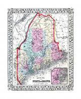
| Maine 1887 County and Township Map |
Maine |
Maine 1887 County and Township Map |
M. Bradley and ... |
1887 |
|
| Casco Bay Chart 1870 Maine |
Maine |
Casco Bay Chart 1870 Maine |
Benjamin Peirce |
1870 |
|
| Maine State Map 1866 |
Maine |
Maine State Map 1866 |
A. J. Johnson |
1866 |
|
| Maine State Map 1855 |
Maine |
Maine State Map 1855 |
Geo. N. Colby |
1855 |
|
| Maine State Map 182x |
Maine |
Maine State Map 182x |
Perkins, A.T. |
182x |
|
| Maine Small Tract Owners |
Minnesota |
Otter Tail County 1974 |
Title Atlas Com... |
1974 |
|
| Maine Small Tract Owners |
Minnesota |
Otter Tail County 1982 |
Title Atlas Com... |
1982 |
|
| Maine - Small Tract Owners |
Minnesota |
Otter Tail County 1993 |
Title Atlas Com... |
1993 |
|
| Marathon County - Knowlton, Stettin, Maine |
Wisconsin |
Wisconsin State Atlas 1930c |
W. W. Hixson an... |
1930 |
|
| Maine - Small Tract Owners |
Minnesota |
Otter Tail County 1993 |
Farm and Home P... |
1993 |
|
| Maine Township |
New York |
Broome County 1876 |
Everts, Ensign ... |
1876 |
|
| Maine Township, Leeman P.O. |
Wisconsin |
Outagamie County 1917 |
Geo. A. Ogle & ... |
1917 |
|
| Maine Prairie Township 1 |
Minnesota |
Stearns County 1925 |
The Farmer |
1925 |
|
| Maine Prairie Township - South |
Minnesota |
Stearns County 1982 |
Title Atlas Com... |
1982 |
|
| Maine Township, Monitor Falls |
Minnesota |
Otter Tail County 1884 |
Warner & Foote |
1884 |
|
| Maine Prairie T122N-R28W |
Minnesota |
Stearns County 1967 |
Directory Servi... |
1967 |
|
| Maine Prairie T122N-R28W |
Minnesota |
Stearns County 1978 |
Directory Servi... |
1978 |
|
| Maine Prairie T122N-R28W |
Minnesota |
Stearns County 1981 |
Directory Servi... |
1981 |
|
| Maine Prairie T122N-R28W |
Minnesota |
Stearns County 1985 |
Directory Servi... |
1985 |
|
| Cedar, Maine T132N-R95W |
North Dakota |
Adams County 1968 |
Directory Servi... |
1968 |
|
| Cedar, Maine T132N-R95W |
North Dakota |
Adams County 1968 |
Directory Servi... |
1968 |
|
| Maine Prairie Township - East |
Minnesota |
Stearns County 1969 |
Farm & Ranch Di... |
1969 |
|
| Portland - Maine - Harbor Chart 1854 |
Maine |
Portland Harbor Chart 1854 Maine |
Coast Survey Of... |
1854 |
|
| Casco Bay Chart 1933 Number 315 Maine |
Maine |
Casco Bay Chart 1933 Number 315 Mai... |
US Coast and Ge... |
1933 |
|
| Portland Harbor Chart 1862 Maine |
Maine |
Portland Harbor Chart 1862 Maine |
A. D. Bache U. ... |
1862 |
|
| Maine |
New York |
Broome County 1866 |
Beers & Beers |
1866 |
|
| Legend Map |
Maine |
Maine State Atlas 1961 to 1964 High... |
Maine State Hig... |
1961 |
|
| Mileage Log |
Maine |
Maine State Atlas 1961 to 1964 High... |
Maine State Hig... |
1961 |
|
| Maine Prairie, Collegeville, Wardeville |
Minnesota |
Stearns County 1896 |
Pinkney & Brown |
1896 |
|
| Maine Township, Pickerel Lake |
Minnesota |
Otter Tail County 1912 |
Geo. A. Ogle & ... |
1912 |
|
| Taylor Township, Maine, Moravia |
Iowa |
Appanoose County 1946 |
R. C. Booth Ent... |
1946 |
|
| Fairhaven, Lynden and Maine Prairie Townships |
Minnesota |
Stearns County 1963 |
Farm Plat Book ... |
1963 |
|
| New Maine Township, Middle River |
Minnesota |
Marshall County 1956 |
K. R. Thompson ... |
1956 |
|
| Maine Township, Central City, Rogers |
Iowa |
Linn County 1921 |
Midland Map and... |
1921 |
|
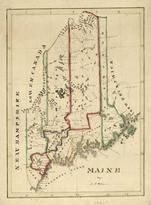
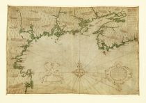
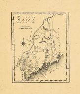
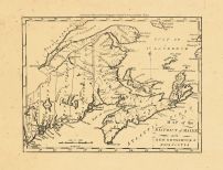
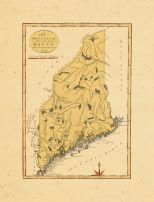
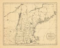
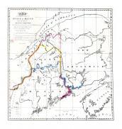
| Sullivan's District Map of Maine 1795 |
Maine |
Sullivan's District Map of Maine 17... |
Sullivan |
1795 |
|
| Maine State Map 1855 Wall Map |
Maine |
Maine State Map 1855 Wall Map |
J. B. Mansfield |
1855 |
|
| Maine Township, Central City, Wapsipinicon River |
Iowa |
Linn County 195x |
Farm Plat Book ... |
195x |
|
| Title Page |
Maine |
Maine State Atlas 1961 to 1964 High... |
Maine State Hig... |
1961 |
|
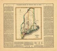
| Maine State Map 1799c MHS Digital Image 5103 |
Maine |
Maine State Map 1799c MHS Digital I... |
Osgood Carleton |
1799c |
|
| Maine Prairie Township, Kimball Prairie, Marty |
Minnesota |
Stearns County 1963 |
Farm Plat Book ... |
1963 |
|
| Maine Prairie Township 2, Business Directory 33 |
Minnesota |
Stearns County 1925 |
The Farmer |
1925 |
|
| Maine T85N-R6W |
Iowa |
Linn County 1976 Published by Direc... |
Directory Servi... |
1976 |
|
| Maine T85N-R6W |
Iowa |
Linn County 1980 Published by Direc... |
Directory Servi... |
1980 |
|
| Maine T85N-R6W |
Iowa |
Linn County 1982 Published by Direc... |
Directory Servi... |
1982 |
|
| Maine Prairie, Collegeville, Wardeville |
Minnesota |
Stearns County 1896 published by C.... |
C.M. Foote & Co |
1896 |
|
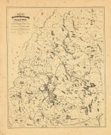
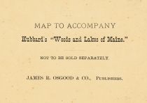
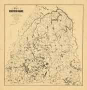
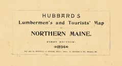
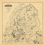
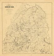
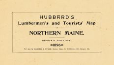
| Hunting and Fishing Map of Northern Maine from 190... |
Maine |
Hunting and Fishing Map of Northern... |
Newton Journal |
1907 |
|
| Maine State Map 1908 Revised 1914 |
Maine |
Maine State Map 1908 Revised 1914 |
L. L. Poates |
1914 |
|
| Index, Table of Contents |
Maine |
Maine State Atlas 1961 to 1964 High... |
Maine State Hig... |
1961 |
|
| St George s River and Muscle Ridge Channel Chart 1... |
Maine |
St. George's River and Muscle Ridge... |
U.S. Coast Surv... |
1864 |
|
| Penobscot River Chart 1889 Bangor and Bucksport Ma... |
Maine |
Penobscot River Chart 1889 Bangor a... |
U. S. Corps of ... |
1889 |
|
| Maine 1754 Coast and Rivers MHS Digital Image 2731 |
Maine |
Maine 1754 Coast and Rivers MHS Dig... |
Thomas Johnston |
1754 |
|
| 34, Federal, Mountford, Marquand Leather Co., Main... |
Maine |
Portland 1886 |
Sanborn Map and... |
1886 |
|
| Maine, Braceville T32N-R8E |
Illinois |
Grundy County 1994 Published by Far... |
Farm and Home P... |
1994 |
|
| Maine, Braceville T32N-R8E |
Illinois |
Grundy County 1994 Published by Far... |
Farm and Home P... |
1994 |
|
| Maine, Braceville T32N-R8E |
Illinois |
Grundy County 1994 Published by Far... |
Farm and Home P... |
1994 |
|
| Maine, Braceville T32N-R8E |
Illinois |
Grundy County 1994 Published by Far... |
Farm and Home P... |
1994 |
|
| Maine, Braceville T32N-R8E |
Illinois |
Grundy County 2002 Published by Far... |
Farm and Home P... |
2002 |
|
| Maine, Braceville T32N-R8E |
Illinois |
Grundy County 2002 Published by Far... |
Farm and Home P... |
2002 |
|
| Maine, Braceville T32N-R8E |
Illinois |
Grundy County 2002 Published by Far... |
Farm and Home P... |
2002 |
|
| Maine, Braceville T32N-R8E |
Illinois |
Grundy County 2002 Published by Far... |
Farm and Home P... |
2002 |
|
| Maine, Braceville T32N-R8E |
Illinois |
Grundy County 1998 Published by Far... |
Farm and Home P... |
1998 |
|
| Maine, Braceville T32N-R8E |
Illinois |
Grundy County 1998 Published by Far... |
Farm and Home P... |
1998 |
|
| Maine, Braceville T32N-R8E |
Illinois |
Grundy County 1998 Published by Far... |
Farm and Home P... |
1998 |
|
| Maine, Braceville T32N-R8E |
Illinois |
Grundy County 1998 Published by Far... |
Farm and Home P... |
1998 |
|
| Portland Harbor Chart 1855 Maine |
Maine |
Portland Harbor Chart 1855 Maine |
A. D. Bache |
1855 |
|
| Eastern Seaboard Chart 1616 Reprinted in 1841 Virg... |
Maine |
Eastern Seaboard Chart 1616 Reprint... |
Royal Archives ... |
1841 |
|
| Richmond's Island Harbor Chart 1851 Maine |
Maine |
Richmond's Island Harbor Chart 1851... |
A. D. Bache |
1851 |
|
| Maine to Rhode Island 1851 Coast Survey Chart |
Rhode Island |
Maine to Rhode Island 1851 Coast Su... |
A. D. Bache Sup... |
1851 |
|
| Outagamie County - Ellington, Grand Chute, Center,... |
Wisconsin |
Wisconsin State Atlas 1930c |
W. W. Hixson an... |
1930 |
|
| Casco Bay Chart 1870 Maine - Hand Coloring by Joh... |
Maine |
Casco Bay Chart 1870 Maine - Hand C... |
Benjamin Peirce |
1870 |
|
| Oxford and Franklin Counties, Maine - Coos County,... |
Maine |
Oxford and Franklin Counties, Maine... |
Carter, Augustu... |
1899 |
|
| Maine Prairie Township, Pearl Lake, Goodners, Isla... |
Minnesota |
Stearns County 1982 |
Title Atlas Com... |
1982 |
|
| Portland Harbor Chart 1862 Maine - Hand Colored by... |
Maine |
Portland Harbor Chart 1862 Maine - ... |
A. D. Bache U. ... |
1862 |
|
| Portland Harbor Chart 1862 Maine - Hand Colored by... |
Maine |
Portland Harbor Chart 1862 Maine - ... |
A. D. Bache U. ... |
1862 |
|
| Portland Harbor Chart 1862 Maine - Hand Colored by... |
Maine |
Portland Harbor Chart 1862 Maine - ... |
A. D. Bache U. ... |
1862 |
|
| Maine Prairie T122N-R28W |
Minnesota |
Stearns County 1982 Published by Di... |
Directory Servi... |
1982 |
|
| Coggon State Bank, Maine Valley Stock Farm, Leno H... |
Iowa |
Linn County 1921 |
Midland Map and... |
1921 |
|
| Maine Prairie Township 2, Kimball, Willow Lake |
Minnesota |
Stearns County 1963 Published by Th... |
Thomas O. Nelso... |
1963 |
|
| Maine Prairie Township 2, Kimball, Willow Lake, Be... |
Minnesota |
Stearns County 1947 |
Thomas O. Nelso... |
1947 |
|
| Cumberland County - Section 12f - Brunswick, Harps... |
Maine |
Maine State Atlas 1961 to 1964 High... |
Maine State Hig... |
1961 |
|
| Port Crane, Castle Creek, Maine, Lisles |
New York |
Broome County 1866 |
Beers & Beers |
1866 |
|
| Blairsville Township, Hurst, Clifford, West Part, ... |
Illinois |
Williamson County 1908 |
Geo. A. Ogle & ... |
1908 |
|
| York River and Cape Neddick Harbors Chart 1854 Mai... |
Maine |
York River and Cape Neddick Harbors... |
Bache |
1854 |
|
| Maine Prairie Township - East, Fairhaven Township ... |
Minnesota |
Stearns County 1982 |
Title Atlas Com... |
1982 |
|
| Aroostook County - Section 2 - Allagash Plantation... |
Maine |
Maine State Atlas 1961 to 1964 High... |
Maine State Hig... |
1961 |
|
| Aroostook County - Section 5 - Depot Lake, St. Joh... |
Maine |
Maine State Atlas 1961 to 1964 High... |
Maine State Hig... |
1961 |
|
| Aroostook County - Section 7 - Ashland, Garfield, ... |
Maine |
Maine State Atlas 1961 to 1964 High... |
Maine State Hig... |
1961 |
|
| York River Harbor Chart 1854 Maine |
Maine |
York River Harbor Chart 1854 Maine |
U.S.C. & G. S. |
1854 |
|
| Aroostook County - Section 6 - Allagash River, St.... |
Maine |
Maine State Atlas 1961 to 1964 High... |
Maine State Hig... |
1961 |
|
| Aroostook County - Section 3 - Fort Kent, Wintervi... |
Maine |
Maine State Atlas 1961 to 1964 High... |
Maine State Hig... |
1961 |
|
| Aroostook County - Section 8 - Presque Isle, Carib... |
Maine |
Maine State Atlas 1961 to 1964 High... |
Maine State Hig... |
1961 |
|
| Cumberland County - Section 11d - New Gloucester, ... |
Maine |
Maine State Atlas 1961 to 1964 High... |
Maine State Hig... |
1961 |
|
| Hancock County - Section 16 - Eastbrook, Aurora, A... |
Maine |
Maine State Atlas 1961 to 1964 High... |
Maine State Hig... |
1961 |
|
| Lincoln County - Boothbay Harbor, Dresden, New Cas... |
Maine |
Maine State Atlas 1961 to 1964 High... |
Maine State Hig... |
1961 |
|
| Oxford County - Section 25 - Hanover, Upton, Bethe... |
Maine |
Maine State Atlas 1961 to 1964 High... |
Maine State Hig... |
1961 |
|
| Penobscot County - Section 30 - Maxfield, Edinburg... |
Maine |
Maine State Atlas 1961 to 1964 High... |
Maine State Hig... |
1961 |
|
| Somerset County - Section 46 - Lexington, Concord,... |
Maine |
Maine State Atlas 1961 to 1964 High... |
Maine State Hig... |
1961 |
|
| Somerset County - Section 47 - Hartland, Fairfield... |
Maine |
Maine State Atlas 1961 to 1964 High... |
Maine State Hig... |
1961 |
|
| Maine Township, Buffalo township, Waubeek, Central... |
Iowa |
Linn County 1895 |
S. N. Parsons, ... |
1895 |
|
| Maine Prairie Township, Pearl Lake, Kimball, Willo... |
Minnesota |
Stearns County 1896 published by C.... |
C.M. Foote & Co |
1896 |
|
| Cumberland County - Section 11b - Naples, Sebago L... |
Maine |
Maine State Atlas 1961 to 1964 High... |
Maine State Hig... |
1961 |
|
| Piscataquis County - Section 35 - Wels, Millinocke... |
Maine |
Maine State Atlas 1961 to 1964 High... |
Maine State Hig... |
1961 |
|
| Androscoggin County - Section 1 - Sabattus, Poland... |
Maine |
Maine State Atlas 1961 to 1964 High... |
Maine State Hig... |
1961 |
|
| Aroostook County - Section 10 - Island Falls, Amit... |
Maine |
Maine State Atlas 1961 to 1964 High... |
Maine State Hig... |
1961 |
|
| Aroostook County - Section 4 - Frenchville, Stockh... |
Maine |
Maine State Atlas 1961 to 1964 High... |
Maine State Hig... |
1961 |
|
| Cumberland County - Section 11a - Gorham, Westbroo... |
Maine |
Maine State Atlas 1961 to 1964 High... |
Maine State Hig... |
1961 |
|
| Franklin County - Section 13 - Stetsontown, Eustis... |
Maine |
Maine State Atlas 1961 to 1964 High... |
Maine State Hig... |
1961 |
|
| Franklin County, Jay, Chesterville, Wilton, Weld, ... |
Maine |
Maine State Atlas 1961 to 1964 High... |
Maine State Hig... |
1961 |
|
| Kennebec County - Section 19 - Rome, Monmouth, Lit... |
Maine |
Maine State Atlas 1961 to 1964 High... |
Maine State Hig... |
1961 |
|
| Oxford County - Section 24 - Parmachenee, Cupsupti... |
Maine |
Maine State Atlas 1961 to 1964 High... |
Maine State Hig... |
1961 |
|
| Oxford County - Section 27 - Brownfield, Porter, D... |
Maine |
Maine State Atlas 1961 to 1964 High... |
Maine State Hig... |
1961 |
|
| Sagadahoc County - Section 40 - Bowdoin, Richmond,... |
Maine |
Maine State Atlas 1961 to 1964 High... |
Maine State Hig... |
1961 |
|
| Waldo County - Section 48 - Searsport, Lincolnvill... |
Maine |
Maine State Atlas 1961 to 1964 High... |
Maine State Hig... |
1961 |
|
| Washington County - Section 51 - Harrington, Deblo... |
Maine |
Maine State Atlas 1961 to 1964 High... |
Maine State Hig... |
1961 |
|
| York County - Section 53a - Limerick, Newfield, So... |
Maine |
Maine State Atlas 1961 to 1964 High... |
Maine State Hig... |
1961 |
|
| Stearns - Maine Prairie, Lynden, Fairhaven, Clearw... |
Minnesota |
Minnesota State Atlas 1925c |
W. W. Hixson & ... |
1925c |
|
| Washington County - Section 50 - Crawford, Grand L... |
Maine |
Maine State Atlas 1961 to 1964 High... |
Maine State Hig... |
1961 |
|
| Maine Prairie Township, Pearl Lake, Kiimball, Swam... |
Minnesota |
Stearns County 1969 |
Farm & Ranch Di... |
1969 |
|
| Aroostook County - Section 9 - Monticello, Bridgew... |
Maine |
Maine State Atlas 1961 to 1964 High... |
Maine State Hig... |
1961 |
|
| Franklin County - Section 15 - Avon, Temple, Phill... |
Maine |
Maine State Atlas 1961 to 1964 High... |
Maine State Hig... |
1961 |
|
| Kennebec County, Pittston, Gardner, augusta, Monmo... |
Maine |
Maine State Atlas 1961 to 1964 High... |
Maine State Hig... |
1961 |
|
| Oxford County - Section 26 - Mexico, Rumford, Peru... |
Maine |
Maine State Atlas 1961 to 1964 High... |
Maine State Hig... |
1961 |
|
| Penobscot County - Section 29 - Soldiertown, Wels,... |
Maine |
Maine State Atlas 1961 to 1964 High... |
Maine State Hig... |
1961 |
|
| Penobscot County - Section 32 - Garland, Dexter, D... |
Maine |
Maine State Atlas 1961 to 1964 High... |
Maine State Hig... |
1961 |
|
| Sagadahoc County - Phippsburg, Georgetown, Richmon... |
Maine |
Maine State Atlas 1961 to 1964 High... |
Maine State Hig... |
1961 |
|
| Somerset County - Section 43 - Sandy ay, Forsyth, ... |
Maine |
Maine State Atlas 1961 to 1964 High... |
Maine State Hig... |
1961 |
|
| York County - Section 53b - Waterboro, Dayton, Hol... |
Maine |
Maine State Atlas 1961 to 1964 High... |
Maine State Hig... |
1961 |
|
| York County - Section 54d - Arundel, Biddeford, Sa... |
Maine |
Maine State Atlas 1961 to 1964 High... |
Maine State Hig... |
1961 |
|
| York County - Section 54e - Berwick, North Berwick... |
Maine |
Maine State Atlas 1961 to 1964 High... |
Maine State Hig... |
1961 |
|
| Franklin County - Section 14 - Coplin Plantation, ... |
Maine |
Maine State Atlas 1961 to 1964 High... |
Maine State Hig... |
1961 |
|
| Piscataquis County - Section 34 - Chesuncook, Alla... |
Maine |
Maine State Atlas 1961 to 1964 High... |
Maine State Hig... |
1961 |
|
| Piscataquis County - Section 37 - Baxter State Par... |
Maine |
Maine State Atlas 1961 to 1964 High... |
Maine State Hig... |
1961 |
|
| Kennebec County - Section 20 - Pittston, Gardiner,... |
Maine |
Maine State Atlas 1961 to 1964 High... |
Maine State Hig... |
1961 |
|
| Knox County - Section 21 - Washington, Thomaston, ... |
Maine |
Maine State Atlas 1961 to 1964 High... |
Maine State Hig... |
1961 |
|
| Oxford County - Porter, Denmark, Lovell, Brownfiel... |
Maine |
Maine State Atlas 1961 to 1964 High... |
Maine State Hig... |
1961 |
|
| Penobscot County - Bradley, Orrington, Holden, Ban... |
Maine |
Maine State Atlas 1961 to 1964 High... |
Maine State Hig... |
1961 |
|
| Penobscot County - Dixmont, Hermon, Levant, Plymou... |
Maine |
Maine State Atlas 1961 to 1964 High... |
Maine State Hig... |
1961 |
|
| Penobscot County - Section 33 - Bangor, Old Town, ... |
Maine |
Maine State Atlas 1961 to 1964 High... |
Maine State Hig... |
1961 |
|
| Piscataquis County - Milo, Dover-Foxcroft, Lake Vi... |
Maine |
Maine State Atlas 1961 to 1964 High... |
Maine State Hig... |
1961 |
|
| Piscataquis County - Section 38 - Parkman, Welling... |
Maine |
Maine State Atlas 1961 to 1964 High... |
Maine State Hig... |
1961 |
|
| Piscataquis County - Section 39 - Brownville, Barn... |
Maine |
Maine State Atlas 1961 to 1964 High... |
Maine State Hig... |
1961 |
|
| Somerset County - Fairfield, Detroit, Hartland, Sk... |
Maine |
Maine State Atlas 1961 to 1964 High... |
Maine State Hig... |
1961 |
|
| Somerset County - Section 42 - Dole, Brassua, Tomh... |
Maine |
Maine State Atlas 1961 to 1964 High... |
Maine State Hig... |
1961 |
|
| Washington County - Section 52 - Machiasport, East... |
Maine |
Maine State Atlas 1961 to 1964 High... |
Maine State Hig... |
1961 |
|
| York County, Wells, Kennebunk, South erwick, Kenne... |
Maine |
Maine State Atlas 1961 to 1964 High... |
Maine State Hig... |
1961 |
|
| Maine Township, Lost Lake, Dead Lake, Pickerel, Br... |
Minnesota |
Otter Tail County 1946 |
Thomas O. Nelso... |
1946 |
|
| Maine Prairie Township 1, Pearl Lake, Goodner's La... |
Minnesota |
Stearns County 1947 |
Thomas O. Nelso... |
1947 |
|
| Androscoggin County - Section 1 - Livermore Falls,... |
Maine |
Maine State Atlas 1961 to 1964 High... |
Maine State Hig... |
1961 |
|
| Aroostook County - Haynesville, Orient, Sherman, H... |
Maine |
Maine State Atlas 1961 to 1964 High... |
Maine State Hig... |
1961 |
|
| Cumberland County - Scarborough, Cape Elizabeth, F... |
Maine |
Maine State Atlas 1961 to 1964 High... |
Maine State Hig... |
1961 |
|
| Penobscot County - Section 28 - Mount Chase, Wels,... |
Maine |
Maine State Atlas 1961 to 1964 High... |
Maine State Hig... |
1961 |
|
| Somerset County - Section 41 - Baker Lake, St. Joh... |
Maine |
Maine State Atlas 1961 to 1964 High... |
Maine State Hig... |
1961 |
|
| Waldo County - Islesboro, Lincolnville, Liberty, N... |
Maine |
Maine State Atlas 1961 to 1964 High... |
Maine State Hig... |
1961 |
|
| Lincoln County - Section 23 - New Castle, Boothbay... |
Maine |
Maine State Atlas 1961 to 1964 High... |
Maine State Hig... |
1961 |
|
| Penobscot County - Section 31 - Greenfield, Grand ... |
Maine |
Maine State Atlas 1961 to 1964 High... |
Maine State Hig... |
1961 |
|
| Somerset County - Section 45 - Moscow, Caratunk Pl... |
Maine |
Maine State Atlas 1961 to 1964 High... |
Maine State Hig... |
1961 |
|
| Washington County - Roque Bluff, Machias, Cutler, ... |
Maine |
Maine State Atlas 1961 to 1964 High... |
Maine State Hig... |
1961 |
|
| Marshall - Whiteford, Rollis, Veldt, New Maine, Sp... |
Minnesota |
Minnesota State Atlas 1925c |
W. W. Hixson & ... |
1925c |
|
| Maine Prairie Township 1, Pearl Lake, Carnelian La... |
Minnesota |
Stearns County 1963 Published by Th... |
Thomas O. Nelso... |
1963 |
|
| Cumberland County - Section 12e - Pownal, North Ya... |
Maine |
Maine State Atlas 1961 to 1964 High... |
Maine State Hig... |
1961 |
|
| Hancock County - Section 18a - Cranberry Isles,Sou... |
Maine |
Maine State Atlas 1961 to 1964 High... |
Maine State Hig... |
1961 |
|
| Hancock County, Winter Harbor, Blue Hill, Castine,... |
Maine |
Maine State Atlas 1961 to 1964 High... |
Maine State Hig... |
1961 |
|
| Knox County - Section 22 - Matinicus Isle, Criehav... |
Maine |
Maine State Atlas 1961 to 1964 High... |
Maine State Hig... |
1961 |
|
| Washington County - Section 49 - Talmadge, Topsfie... |
Maine |
Maine State Atlas 1961 to 1964 High... |
Maine State Hig... |
1961 |
|
| York County - Section 53c - Sanford, Lebanon, Mous... |
Maine |
Maine State Atlas 1961 to 1964 High... |
Maine State Hig... |
1961 |
|
| York County - Section 54f - Kittery, York, Eliot, ... |
Maine |
Maine State Atlas 1961 to 1964 High... |
Maine State Hig... |
1961 |
|
| Marshall County 2, East Park, Huntly, Lake Moose, ... |
Minnesota |
Minnesota State Atlas 1954 |
Thomas O. Nelso... |
1954 |
|
| Aroostook County - Grand Isle, St. Francis, Easton... |
Maine |
Maine State Atlas 1961 to 1964 High... |
Maine State Hig... |
1961 |
|
| Hancock County - Section 17 - Penobscot, Orland, S... |
Maine |
Maine State Atlas 1961 to 1964 High... |
Maine State Hig... |
1961 |
|
| Hancock County - Section 18 -Southwest Harbor, Tre... |
Maine |
Maine State Atlas 1961 to 1964 High... |
Maine State Hig... |
1961 |
|
| Somerset County - Section 44 - Highland Plantation... |
Maine |
Maine State Atlas 1961 to 1964 High... |
Maine State Hig... |
1961 |
|
| Ottertail - Elizabeth, Friberg, Maine, Newton, Blu... |
Minnesota |
Minnesota State Atlas 1925c |
W. W. Hixson & ... |
1925c |
|
| Cumberland County - Section 12g - Cape Elizabeth, ... |
Maine |
Maine State Atlas 1961 to 1964 High... |
Maine State Hig... |
1961 |
|
| Hancock County - Tremont, Long Island, Mount Deser... |
Maine |
Maine State Atlas 1961 to 1964 High... |
Maine State Hig... |
1961 |
|
| Cumberland County - Section 11c - Bridgton, Sebago... |
Maine |
Maine State Atlas 1961 to 1964 High... |
Maine State Hig... |
1961 |
|
| Knox County - Matinicus Isle, Isle Au Haut, Vinalh... |
Maine |
Maine State Atlas 1961 to 1964 High... |
Maine State Hig... |
1961 |
|
| Piscataquis County - Section 36 - Lily Bay State P... |
Maine |
Maine State Atlas 1961 to 1964 High... |
Maine State Hig... |
1961 |
|
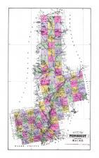
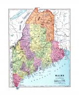
| Boothbay |
Maine |
Maine State Atlas 1884 |
Geo N. Colby & ... |
1884 |
|
| Houlton |
Maine |
Maine State Atlas 1884 |
Geo N. Colby & ... |
1884 |
|
| History 001 |
Maine |
Maine State Atlas 1884 |
Geo N. Colby & ... |
1884 |
|
| History 002 |
Maine |
Maine State Atlas 1884 |
Geo N. Colby & ... |
1884 |
|
| History 003 |
Maine |
Maine State Atlas 1884 |
Geo N. Colby & ... |
1884 |
|
| History 004 |
Maine |
Maine State Atlas 1884 |
Geo N. Colby & ... |
1884 |
|
| History 005 |
Maine |
Maine State Atlas 1884 |
Geo N. Colby & ... |
1884 |
|
| History 006 |
Maine |
Maine State Atlas 1884 |
Geo N. Colby & ... |
1884 |
|
| History 007 |
Maine |
Maine State Atlas 1884 |
Geo N. Colby & ... |
1884 |
|
| History 008 |
Maine |
Maine State Atlas 1884 |
Geo N. Colby & ... |
1884 |
|
| History 009 |
Maine |
Maine State Atlas 1884 |
Geo N. Colby & ... |
1884 |
|
| History 010 |
Maine |
Maine State Atlas 1884 |
Geo N. Colby & ... |
1884 |
|
| History 011 |
Maine |
Maine State Atlas 1884 |
Geo N. Colby & ... |
1884 |
|
| History 012 |
Maine |
Maine State Atlas 1884 |
Geo N. Colby & ... |
1884 |
|
| History 013 |
Maine |
Maine State Atlas 1884 |
Geo N. Colby & ... |
1884 |
|
| History 014 |
Maine |
Maine State Atlas 1884 |
Geo N. Colby & ... |
1884 |
|
| History 015 |
Maine |
Maine State Atlas 1884 |
Geo N. Colby & ... |
1884 |
|
| History 016 |
Maine |
Maine State Atlas 1884 |
Geo N. Colby & ... |
1884 |
|
| History 017 |
Maine |
Maine State Atlas 1884 |
Geo N. Colby & ... |
1884 |
|
| Androscoggin County |
Maine |
Maine State Atlas 1884 |
Geo N. Colby & ... |
1884 |
|
| Aroostook County Map |
Maine |
Maine State Atlas 1884 |
Geo N. Colby & ... |
1884 |
|
| Augusta City |
Maine |
Maine State Atlas 1884 |
Geo N. Colby & ... |
1884 |
|
| Belfast City |
Maine |
Maine State Atlas 1884 |
Geo N. Colby & ... |
1884 |
|
| Biddeford and Saco |
Maine |
Maine State Atlas 1884 |
Geo N. Colby & ... |
1884 |
|
| Calais City |
Maine |
Maine State Atlas 1884 |
Geo N. Colby & ... |
1884 |
|
| Cumberland County Map |
Maine |
Maine State Atlas 1884 |
Geo N. Colby & ... |
1884 |
|
| Eastport Village |
Maine |
Maine State Atlas 1884 |
Geo N. Colby & ... |
1884 |
|
| Ellsworth City |
Maine |
Maine State Atlas 1884 |
Geo N. Colby & ... |
1884 |
|
| Fairfield, Skowhegan |
Maine |
Maine State Atlas 1884 |
Geo N. Colby & ... |
1884 |
|
| Franklin County Map |
Maine |
Maine State Atlas 1884 |
Geo N. Colby & ... |
1884 |
|
| Gardiner City |
Maine |
Maine State Atlas 1884 |
Geo N. Colby & ... |
1884 |
|
| Hancock County Map |
Maine |
Maine State Atlas 1884 |
Geo N. Colby & ... |
1884 |
|
| Kennebec County Map |
Maine |
Maine State Atlas 1884 |
Geo N. Colby & ... |
1884 |
|
| Knox County Map |
Maine |
Maine State Atlas 1884 |
Geo N. Colby & ... |
1884 |
|
| Oxford County Map |
Maine |
Maine State Atlas 1884 |
Geo N. Colby & ... |
1884 |
|
| Penobscot County Map |
Maine |
Maine State Atlas 1884 |
Geo N. Colby & ... |
1884 |
|
| Piscataquis County Map |
Maine |
Maine State Atlas 1884 |
Geo N. Colby & ... |
1884 |
|
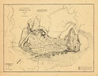
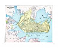
| Portland And vicinity |
Maine |
Maine State Atlas 1884 |
Geo N. Colby & ... |
1884 |
|
| Rockland City |
Maine |
Maine State Atlas 1884 |
Geo N. Colby & ... |
1884 |
|
| Somerset County Map |
Maine |
Maine State Atlas 1884 |
Geo N. Colby & ... |
1884 |
|
| Table of Contents |
Maine |
Maine State Atlas 1884 |
Geo N. Colby & ... |
1884 |
|
| Title Page |
Maine |
Maine State Atlas 1884 |
Geo N. Colby & ... |
1884 |
|
| United States Map |
Maine |
Maine State Atlas 1884 |
Geo N. Colby & ... |
1884 |
|
| Waldo County Map |
Maine |
Maine State Atlas 1884 |
Geo N. Colby & ... |
1884 |
|
| Washington County Map |
Maine |
Maine State Atlas 1884 |
Geo N. Colby & ... |
1884 |
|
| York County Map |
Maine |
Maine State Atlas 1884 |
Geo N. Colby & ... |
1884 |
|
| Lincoln And Sagadahoc Counties Map |
Maine |
Maine State Atlas 1884 |
Geo N. Colby & ... |
1884 |
|
| Index Page |
Maine |
Portland 1955 Hay's Guide to Portla... |
Hay's Drug Stor... |
1955 |
|
| Title Page |
Maine |
Portland 1955 Hay's Guide to Portla... |
Hay's Drug Stor... |
1955 |
|
| Bangor City, Brewer Town |
Maine |
Maine State Atlas 1884 |
Geo N. Colby & ... |
1884 |
|
| Eastport, Machias, Alfred, Kennebunk |
Maine |
Maine State Atlas 1884 |
Geo N. Colby & ... |
1884 |
|
| Town of Gardiner, Farmingdale, Pittston |
Maine |
Maine State Atlas 1884 |
Geo N. Colby & ... |
1884 |
|
| Timber Lands Map 1, Mt. Katahdin, Millinocket |
Maine |
Maine State Atlas 1884 |
Geo N. Colby & ... |
1884 |
|
| Auburn City, Lewiston City |
Maine |
Maine State Atlas 1884 |
Geo N. Colby & ... |
1884 |
|
| Topsham Village, Brunswick Village |
Maine |
Maine State Atlas 1884 |
Geo N. Colby & ... |
1884 |
|
| Western Hemisphere, Eastern Hemisphere |
Maine |
Maine State Atlas 1884 |
Geo N. Colby & ... |
1884 |
|
| Gorham, Farmington Village, Yarmouth, Bridgton |
Maine |
Maine State Atlas 1884 |
Geo N. Colby & ... |
1884 |
|
| Jonesboro, Jonesport, Whitneyville, Indian River |
Maine |
Maine State Atlas 1884 |
Geo N. Colby & ... |
1884 |
|
| Vanceboro, Harrington, Jacksonbrook, MeddyBemps, Y... |
Maine |
Maine State Atlas 1884 |
Geo N. Colby & ... |
1884 |
|
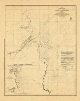
| Page 009, 010, and 011 - Portland Harbor |
Maine |
Portland 1955 Hay's Guide to Portla... |
Hay's Drug Stor... |
1955 |
|
| Page 024 - Roads Around Cape Elizabeth Map |
Maine |
Portland 1955 Hay's Guide to Portla... |
Hay's Drug Stor... |
1955 |
|
| Page 025 and 026 - Numbered Highways Map in and ou... |
Maine |
Portland 1955 Hay's Guide to Portla... |
Hay's Drug Stor... |
1955 |
|
| Timber Lands Map 3, Piscataquis County, Penobscott... |
Maine |
Maine State Atlas 1884 |
Geo N. Colby & ... |
1884 |
|
| Great Works or Bradley Village, Oldtown, Orono, Bu... |
Maine |
Maine State Atlas 1884 |
Geo N. Colby & ... |
1884 |
|
| Foxcroft Village, Dover Village, Guilford, Millo V... |
Maine |
Maine State Atlas 1884 |
Geo N. Colby & ... |
1884 |
|
| Fort Fairfield, Presque Isle, Mechanic Falls Villa... |
Maine |
Maine State Atlas 1884 |
Geo N. Colby & ... |
1884 |
|
| Timber Lands Map 2, Washington County, Hancock Cou... |
Maine |
Maine State Atlas 1884 |
Geo N. Colby & ... |
1884 |
|
| Winthrop Village, Richmond Village, Dexter Village... |
Maine |
Maine State Atlas 1884 |
Geo N. Colby & ... |
1884 |
|
| Camden, Wiscasset Village, Thomaston Village, New ... |
Maine |
Maine State Atlas 1884 |
Geo N. Colby & ... |
1884 |
|
| Norway Village, South Paris, Paris Hill, Bethel Hi... |
Maine |
Maine State Atlas 1884 |
Geo N. Colby & ... |
1884 |
|
| Casco Bay, Scarborough, Cape Elizabeth, Portland, ... |
Maine |
Maine State Atlas 1884 |
Geo N. Colby & ... |
1884 |
|
| Timber Lands Map 4, Aroostook County, Penobscot Co... |
Maine |
Maine State Atlas 1884 |
Geo N. Colby & ... |
1884 |
|
| Timber Lands Map 6, Moosehead Lake, Penobscott Riv... |
Maine |
Maine State Atlas 1884 |
Geo N. Colby & ... |
1884 |
|
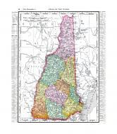
| Franklin County 1938 General Highway Map Composite |
Maine |
Franklin County 1938 General Highwa... |
Maine State Hig... |
1938 |
|
| Timber Lands Map 5, Fort Kent, Aroostook, Presque ... |
Maine |
Maine State Atlas 1884 |
Geo N. Colby & ... |
1884 |
|
| Franklin County - Middle Plate, Rangeley, Sandy Ri... |
Maine |
Franklin County 1938 General Highwa... |
Maine State Hig... |
1938 |
|
| Franklin County - North Plate, Gorham Gore, Coburn... |
Maine |
Franklin County 1938 General Highwa... |
Maine State Hig... |
1938 |

 Cart
Cart