
 Cart
Cart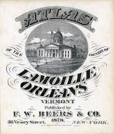
Vermont
Lamoille and Orleans Counties 1878
F. W. Beers & Co., 1878
Image Quality:
 High
High
 Indicates a map that is georeferenced


These antique maps and atlases are part of the Historic Map Works, Residential Genealogy™ historical map collection, the largest digital collection of rare, ancient, old, historical, cadastral and antiquarian maps of its type. Read about the collection. Browse entire collection.
Research Prints
All research prints will be printed with a light watermark.
Research Prints are color prints fitted to 11" x 17" paper ideal for research and educational use, but not suitable for framing as center seams and imperfections will not be removed. Orders for less than 15 research prints will be mailed folded in an envelope. Larger orders will be shipped flat via UPS.
All research prints will be printed with a light watermark.
Click here to see an example of a research print.
Research Prints are color prints fitted to 11" x 17" paper ideal for research and educational use, but not suitable for framing as center seams and imperfections will not be removed. Orders for less than 15 research prints will be mailed folded in an envelope. Larger orders will be shipped flat via UPS.