Louisiana Historical Maps and Atlases
The state of Louisiana collection contains 30 atlases spanning 282 years of growth and development (1718 through 2000).
Within the atlases are 495 historical maps, illustrations, and histories many of which contain family names ideal for genealogical research. Others are rare antique maps, part of the collection by an exclusive arrangement with the Osher Map Library. The state of Louisiana has 16 of these antiquarian maps dating back as early as 1718.
|
Displaying 1- 30 of 30 in total
|
|
Click on a column header to sort table.
|
Name |
Attributes |
Quality |
Publisher |
State |
Date |
|
Name |
Atlas |
Attributes |
Publisher |
Date |
Collection |
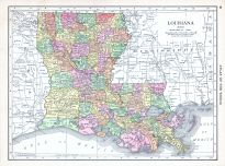 |
Louisiana |
World Atlas 1913 |
 |
Rand McNally and Com... |
1913 |
HMW |
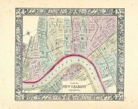 |
New Orleans |
World Atlas 1864 Mitchells New... |
|
S. Augustus Mitchell |
1864 |
HMW |
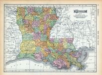 |
Page 088 - Louisiana |
World Atlas 1911c from Minneso... |
|
Rand, McNally and Co... |
1911 |
HMW |
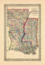 |
Map - Page 1 |
County Map of the states of Ar... |
|
S. Augustus Mitchell... |
1867 |
OML |
|
 |
Map - Page 1 |
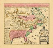
Carte de la Nouvelle France...... |
|
Chatelain, Henry Abr... |
1719 |
OML |
|
 |
Map - Page 1 |
County map of the state of Ark... |
|
S. Augustus Mitchell... |
1867 |
OML |
|
 |
Map - Page 1 - AFBEELDINGE/van... |
AFBEELDINGE/van't zeer vermaar... |
|
CHATELAIN, HENRI ABR... |
1720 |
OML |
|
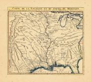 |
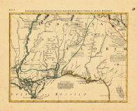
Map - Page 1 - CARTE DE LA LOU... |
CARTE DE LA LOUISIANE DE DU CO... |
|
DELISLE, GUILLAUME /... |
1737 |
OML |
|
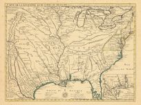 |
Map - Page 1 - CARTE DE LA LOU... |
CARTE DE LA LOUISIANE ET DU CO... |
|
DELISLE, GUILLAUME |
1718 |
OML |
|
 |
Map - Page 1 - CARTE DE LA NOU... |
CARTE DE LA NOUVELLE FRANCE,ou... |
|
FER, NICOLAS de/OTTE... |
1719- |
OML |
|
 |
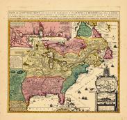
Map - Page 11 - LE COLONIE UNI... |
LE COLONIE UNITE DELL AMERICA ... |
|
MITCHELL, JOHN / ZAT... |
1778 |
OML |
|
 |
Map - Page 3 - ATLAS/TO ACCOMP... |
ATLAS/TO ACCOMPANY THE OFFICIA... |
|
DAVIS, MAJOR GEORGE ... |
1891 |
OML |
|
 |
Map - Page 3 - UNITED STATES o... |
UNITED STATES of Nth. AMERICA/... |
|
TARDIEU, P.F. [AFTER... |
1812 |
OML |
|
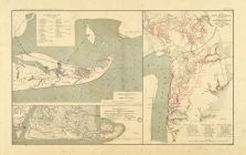 |
Map - Page 4 - ATLAS/TO ACCOMP... |
ATLAS/TO ACCOMPANY THE OFFICIA... |
|
DAVIS, MAJOR GEORGE ... |
1891 |
OML |
|
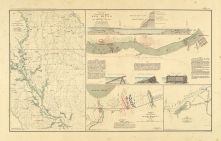 |
Map - Page 4 - ATLAS/TO ACCOMP... |
ATLAS/TO ACCOMPANY THE OFFICIA... |
|
DAVIS, MAJOR GEORGE ... |
1891 |
OML |
|
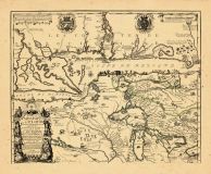 |
Map - Page 4 - Le Cours du/MIS... |
Le Cours du/MISSISIPI,/ou de S... |
|
FER, NICOLAS DE |
1718 |
OML |
|
|
Displaying 1- 30 of 30 in total
|
|

 Cart
Cart