Wyoming Historical Maps and Atlases
The state of Wyoming collection contains 48 atlases spanning 129 years of growth and development (1870 through 1999).
Within the atlases are 1,715 historical maps, illustrations, and histories many of which contain family names ideal for genealogical research. Others are rare antique maps, part of the collection by an exclusive arrangement with the Osher Map Library. The state of Wyoming has 13 of these antiquarian maps dating back as early as 1870.
|
Displaying 1- 48 of 48 in total
|
|
Click on a column header to sort table.
|
Name |
Attributes |
Quality |
Publisher |
State |
Date |
|
Name |
Atlas |
Attributes |
Publisher |
Date |
Collection |
 |
Page 097 - Wyoming |
World Atlas 1911c from Minneso... |
 |
Rand, McNally and Co... |
1911 |
HMW |
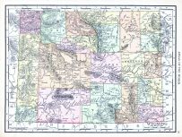 |
Wyoming |
World Atlas 1913 |
|
Rand McNally and Com... |
1913 |
HMW |
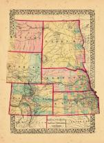 |
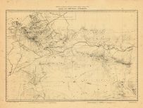
Map - Page 1 |
County map of Dakota, Wyoming,... |
|
S. Augustus Mitchell... |
1870 |
OML |
|
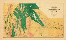 |
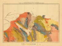
Map - Page 1 - ECONOMIC MAP/OF... |
ECONOMIC MAP/OF PORTIONS OF/WY... |
|
HAYDEN, F[ERDINAND] ... |
1878 |
OML |
|
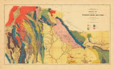 |
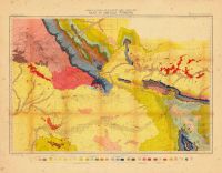
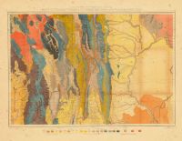
Map - Page 1 - GEOLOGICAL MAP/... |
GEOLOGICAL MAP/OF PORTIONS OF/... |
|
HAYDEN, F.V., A.C. P... |
1878 |
OML |
|
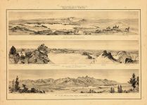 |
Map - Page 1 - PANORAMIC VIEWS... |
PANORAMIC VIEWS./GLACIAL LAKE/... |
|
HAYDEN, F[ERDINAND] ... |
1878 |
OML |
|
 |
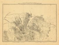
Map - Page 1 - PART OF CENTRAL... |
PART OF CENTRAL WYOMING |
|
HAYDEN, F[ERDINAND] ... |
1878 |
OML |
|
 |
Map - Page 1 - PART OF CENTRAL... |
PART OF CENTRAL WYOMING, |
|
HAYDEN, F[ERDINAND] ... |
1878 |
OML |
|
 |
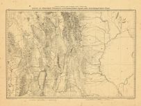
Map - Page 1 - PARTS OF WESTER... |
PARTS OF WESTERN WYOMING AND S... |
|
HAYDEN, F[ERDINAND] ... |
1878 |
OML |
|
 |
Map - Page 1 - PARTS OF WESTER... |
PARTS OF WESTERN WYOMING AND S... |
|
HAYDEN, F[ERDINAND] ... |
1878 |
OML |
|
 |
Map - Page 1 - PARTS OF WESTER... |
PARTS OF WESTERN WYOMING, SOUT... |
|
HAYDEN, F[ERDINAND] ... |
1878 |
OML |
|
 |
Map - Page 1 - PARTS OF WESTER... |
PARTS OF WESTERN WYOMING, SOUT... |
|
HAYDEN, F[ERDINAND] ... |
1878 |
OML |
|
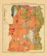 |
Map - Page 1 - PRELIMINARY GEO... |
PRELIMINARY GEOLOGICAL MAP OF ... |
|
HAYDEN, F[ERDINAND] ... |
1878 |
OML |
|
|
Displaying 1- 48 of 48 in total
|
|

 Cart
Cart